Hiking and Biking Trails
For the latest information regarding National Forests in North Carolina, please check out the Forest Service website.
Our public lands offer more than 245 miles of bike trails. In addition, forest roads are also open for mountain biking, unless otherwise signed.
River Walk and Canoe Trails
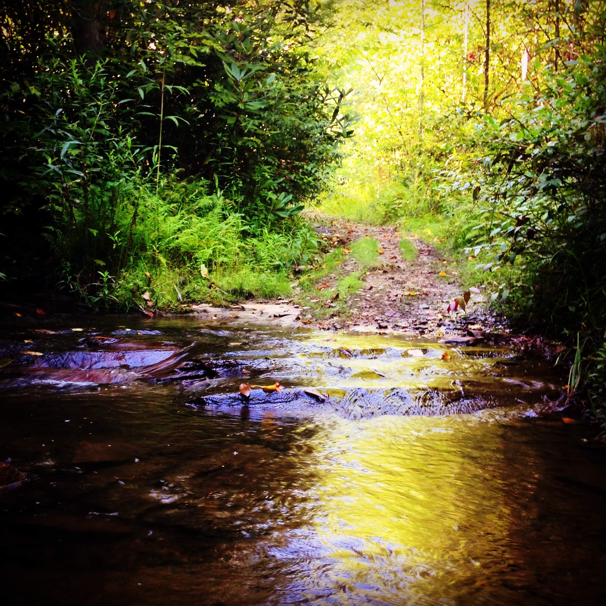
The approximate 3 miles of easy walking trails start at the far end of Konehete Park along the Valley River, and end at the Old L&N Depot by the Hiwassee River bridge. Enjoy walking through Konehete Park then along the river past the historic Leach Place and the abandoned railroad trestle to the Historic L&N Depot.
Directions
The Murphy River Walk is located in Downtown Murphy and has several access points including the L&N Depot, McClelland Street, and Konehete Park.
Google Map coordinates for Murphy River Walk
Piney Knob Trail
Piney Knob
Piney Knob Trail System, 22.3 miles of recreational hiking and mountain biking trails on the 700+ acre Murphy Watershed property off of Piney Knob Hill Road. All trails are dirt single-track trails and built in accordance with International Mountain Bike Association (IMBA) standards.
Google Map coordinates for Piney Knob Trail
Welch Farm
Mainspring’s 57-acre Welch Farm property, acquired in April 2011, contains historic farmland, which dates back to the mid-1800s plantation of John and Betty Welch. Today Mainspring manages the property for its beauty, recreation value, water quality and aquatic habitat, wildlife habitat, productive farmland, and rich cultural heritage.
Learn more about the conservation of Welch Farm.
Mainspring is happy to have you visit and explore the Welch Farm Property. When there, please respect the following policies:
What we allow: Foot travel, paddle boating, fishing, swimming (at your own risk), and hunting.
What we do not allow: In order to protect the water, plants, and soils; all-terrain vehicles (ATVs), mountain biking, and horseback riding are not permitted.
Nature Trails at John C. Campbell Folk School
The Folk School offers numerous nature trails open to the public during daylight hours. You’ll find many interesting points on the scenic paths: the Rainbow Bridge, the Herb Garden and the Corn Maiden just to name a few…
Little Brasstown Creek Park
Brasstown Creek and its branch, Little Brasstown Creek, provide a beautiful accompaniment as you explore the natural splendor of native plants and trees and over 120 bird species. Little Brasstown Creek Park trails include:
- Blackberry Loop: .25 mile
- Downtown Trail: .25 mile
- Herb Garden Trail: .13 mile
- Gazebo Trail: .25 mile
- Rivercane Walk: .25 mile (loop) *
- Northside Trail: .4 mile
- Southside Trail: .3 mile
* Rivercane Walk
Opened in 2006, this quarter-mile long, creekside loop trail features installations from area artists honoring the strong Cherokee heritage of the Appalachian area. Be sure to see Eagle Dancer, Uktena Serpent, Clan Cane Pole, Rivercane Rendezvous, Corn Maiden, Seven Clans Poles, and Medicine Wheel & Fire Circle.
Other Nature Trails
The chipped bark paths meandering between studios and housing provide their own beautiful trek, as do our other nature trails:
- Mill House Trail: .6 mile (loop)
- White Oak Trail: .4 mile (loop)
More information and a map available HERE.
Cherokee Lake Recreation Area
Closed Seasonally January 2- April 1
Recreation areas with activity Lake and Pond Fishing: Cherokee Lake offers fishing activities. Accessible Pier available.
More information HERE.
Ramsey Bluff Bike Trail System
The Ramsey Bluff Bike Trail System is located at the Hanging Dog Campground area, and offers under-utilized adventure in Mountain biking, hiking, and cross-country running. The eight mile labyrinth of trails is actually a group of connected loops, allowing an interesting variety of combinations for repeat visitors to explore. The trail difficulty ranges from easy to moderate, and range from 1500 to 1900’ in elevation. The trail system has two good access points with parking: the Upper Parking area above the Boat Launch, and Iceberg Hill on Ramsey Bluff Road. Restrooms are near the Boat Launch trailhead.
Jack Rabbit Trail
Jackrabbit Mountain trail system provides access to over 14 miles of trails with a main central loop, which is easy and nearly level, and has junctions with several more difficult side trails, traveling to some interesting destinations such as ridgetops and beaches.
Directions
From Murphy, follow Hwy 64 for 19 miles and turn right on Hwy 175 South. Go 1 mile and turn right to stay on Hwy 175, crossing a long one-lane concrete bridge over an arm of the lake. Go 2.5 miles and turn right onto Jack Rabbit Road. Bear left after 250 ft., staying on Jack Rabbit Rd. The signed parking area is on the left after about 1/2 mile.
Google Map Coordinates for Jack Rabbit Trail Head
Fires Creek Recreation Area
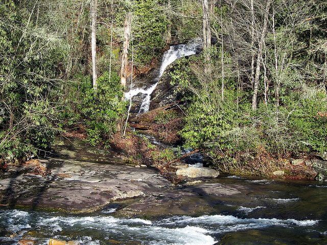
Leatherwood Falls
The 25-mile Rim Trail in the Fires Creek Backcountry Area climbs the ridge around Fires Creek and makes a large loop. The trail offers vistas as it crosses several high elevation balds. From the Leatherwood Falls Picnic Area, a 0.7 mile loop goes to Leatherwood Falls.
Directions:
From Murphy, travel US 64 towards Hayesville. At Hills Store turn left on Fires Creek Road (NC175) for 2.5 miles, left on Fires Creek Wildlife Road (SR 1344) for two miles. The recreation center is on the left after the bridge.
Google Map Coordinates for Fires Creek Picnic Area
Ocoee Whitewater Center
The information center is currently closed due to a fire a few years back, but the trails are still open and accessible. Check with the Cherokee National Forest Service District for more information.
Boasting more than 20 miles of trails, this trail system has it all. This trail has tons of options from a hke with history along the 2.4 mile restored segment of the Old Copper Road Trail, or an easy 1 mile stroll around the Olympic course at the Whitewater Center to a screaming 1.5 mile mountain bike ridge on the Thunder Rock Express.
Directions
Located on Hwy 64 approximately 6 miles west of Ducktown, Tennessee. Day use parking is available in the lower lot at the Ocoee Whitewater Center.
Google Map coordinates for Ocoee Whitewater Center
Turtletown Falls Hike

This easy hike allows for visitors to the popular Turtletown Falls. For a bonus waterfall, hike further down stream to see the lower falls before leaving.
Check HERE for more information.
Appalachian Trail
There are two entrances to the Appalachian Trail that are easily accessible from our area and both are 40 minutes away! You can get on the AT at the Nanatahala Outdoor Center in the Nanatahala Gorge on Hwy 74 or you can get on at Winding Stair Gap on the top of Franklin Mountain on Hwy 64. There are many other short day-hike options!
Need Help Getting Around?
Do you need help getting around or planning your next adventure in the great outdoors? Start with our "outdoor life" business directory listing and find the service that can help make your visit to our region memorable.